The primary objective of the SEN4LDN project is to develop, demonstrate and validate a robust and scientifically-sound EO methodology that exploits the high frequency and spatial resolution of open and free-of-charge satellite imagery (principally Sentinels 1 and 2 from the European Copernicus Program) to increase the spatial details of national assessments of land degradation and restoration, and provide synoptic information for countries to plan Land Degradation Neutrality (LDN) interventions at appropriate scales.
Conceptual overview of the SEN4LDN project. Throughout the project user engagement will be key.
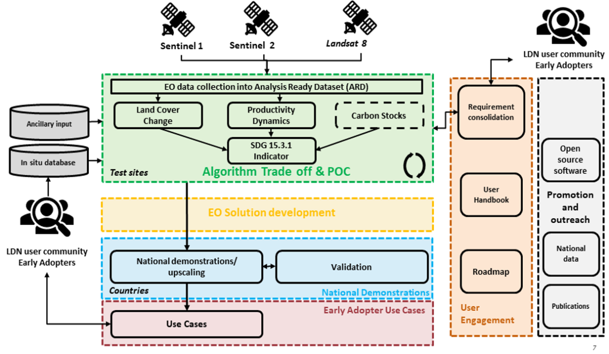
Specific objectives are to
- develop robust automated EO methods to map land cover and its changes (robust change detection for LDN) and land productivity dynamics (robust phenological analysis for LDN) at high spatial resolution;
- investigate methods to integrate the 10-30m data streams with the existing default 300m-1km datasets used in UNCCD 2015 land degradation baseline;
- develop an integrated EO-based solution to assess land degradation; and
- demonstrate the adequacy of the approach in a number of biomes representative of the diversity of land degradation processes.